Hiking Adventures in the Susquehanna River Valley
Hikers of all ages and skill levels will find year-round opportunities to explore parks, forests and scenic trails throughout the Susquehanna River Valley. From peaceful riverside walks to rugged mountain trails with breathtaking overlooks, every season offers a new way to experience the outdoors.
Lace up your boots, hit the trail and discover the beauty waiting around every bend.
Favorite Hikes in the Susquehanna River Valley
Northumberland County
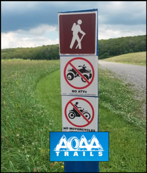
While most of the trails at Anthracite Outdoor Adventure Area are designed for off-road recreation, visitors can enjoy a 3.1-mile walking trail with exercise stations and scenic outlooks. The trail begins at the AOAA Welcome Center and winds through wooded areas and across bridges before reaching Sunset Ridge—an ideal spot for a picnic and beautiful sunset views.
Located in Weiser State Forest, the Roaring Creek Tract offers an 8-mile shared-use trail through peaceful valleys, reservoirs and forest scenery. The area also connects to more than 40 miles of trails within the state forest, making it a great place for longer hikes and outdoor exploration.
-
Miner’s Paths in Weiser State Forest - Explore about 6 miles of marked trails along pathways once used by coal miners in the late 1800s and early 1900s. Miners traveled these routes daily from their homes near Bear Gap to Natalie on their way to work in the coal mines, making these trails a unique way to experience a piece of the region’s history.
Snyder and Union Counties
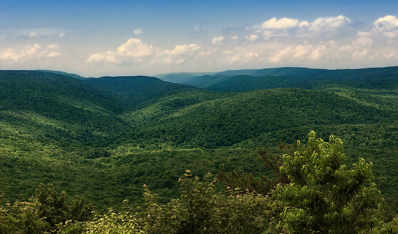
The rugged ridges and deep valleys of Bald Eagle State Forest provide some of the region’s most scenic and challenging hikes.
The Mid State Trail is a 327-mile long-distance hiking trail that passes through Bald Eagle State Forest for about 45 miles. Marked by orange blazes, this mountaintop trail offers remote wilderness hiking and spectacular views along its route.
Covering 5,119 acres, Hook Natural Area preserves an entire watershed within Bald Eagle State Forest. Hikers can explore nearly 30 miles of trails and forest roads through mountain valleys, rhododendron tunnels and towering old-growth trees.
This remote section of Bald Eagle State Forest features 4- and 9-mile loop trails and some of the region’s most stunning vistas. The popular Chimney Rocks overlook provides a dramatic view of Penns Creek and the surrounding valley.
These natural areas feature a 3.4-mile loop trail along Swift Run through towering stands of hemlock and white pine. Some trees in this forest reach more than 150 feet tall, making it one of the most impressive old-growth forests in Pennsylvania.
State Parks with Scenic Hiking
R. B. Winter State Park features over 6 miles of hiking trails, many of which connect with Bald Eagle State Forest for longer backpacking trips. Trails range from easy walks to steep ridge climbs with views over Halfway Lake and the surrounding forest.
Popular trails include:
-
Boiling Spring Trail – 1.4 miles (easy)
-
Rapid Run Nature Trail – 1 mile (easy loop)
-
Bake Oven Trail – ridge-top hiking with mountain laurel
-
Overlook Trail – short but steep climb to scenic views
Located on an 82-acre island in the Susquehanna River, Milton State Park offers 3.5 miles of walking trails through river and island habitats. It’s a great spot for casual hikes, wildlife viewing and scenic riverside strolls.
Shikellamy State Park features two sections for hiking:
Marina Area
Overlook Section
Local Nature Trails
The Conservancy maintains several scenic trails throughout the region.
Dale’s Ridge Trail (Lewisburg)
A 2-mile loop offering ridge-top views of Buffalo Valley along with excellent birding and wildflower viewing.
Koons Trail (Mifflinburg)
A 1-mile loop along Buffalo Creek with wetlands, wildflowers, and bird habitat.
Merrill Linn Trail
A peaceful 1-mile loop off the Mid State Trail in BESF that passes through woodland filled with seasonal vernal pools. This is a remote, rugged loop trail.
The MARC manages parks, 7.3 miles of trails and outdoor recreation programs throughout Montour County, including several scenic hiking areas centered around the Montour Preserve near Danville.
The Montour Preserve offers more than seven miles of trails around the 165-acre Lake Chillisquaque, with routes ranging from short nature walks to longer lakeside hikes. Trails include the Hummingbird Trail (0.2 miles) and the Chillisquaque Trail (3.9 miles), providing opportunities for wildlife viewing, birding and family-friendly outdoor exploration.
Other MARC-managed trail systems include:
-
North Branch Canal Trail – a scenic rail-trail route popular for walking, biking, and running
-
Robbins Trail/Old Reading Line Loop Trail at Hess Recreation Area
-
Hess Loop Trail - America’s oldest known rail-to-trail has been in continuous use as a rail-to-trail since 1897. Historical records also note that Native American paths were heavily traveled along Mahoning Creek through the Hess Recreation area.
With wooded trails, lakeside views and educational exhibits at the Montour Preserve Visitors Center, this area is a great destination for both casual walkers and nature lovers.
The trails at the Ned Smith Center for Nature and Art in Millersburg offer a peaceful hiking experience through forests, fields and wildlife habitats.
Visitors can explore scenic nature trails that wind through the surrounding woods and meadows, providing a quiet place to enjoy birdwatching, photography and seasonal wildflowers. These trails are open to the public and are especially popular for relaxed nature walks and educational programs hosted by the center. Print a copy of the Berry Mountain Trail Guide before you head out to walk.
Riverside Walks & Rail Trails
This 1-mile riverside trail follows the historic path where horses once pulled canal boats along the Susquehanna River. The trail runs 1 mile north parallel to the West Branch of the Susquehanna River and offers scenic river views along the way.
This 11‑acre park along the West Branch of the Susquehanna River offers scenic walking paths, meadows and ponds. Trails follow historic canal remnants and provide interpretive panels about local history and ecology, making it a perfect spot for both casual strolls and learning about the area’s river heritage.
Hiking With Children
Hiking is a wonderful way to interact with your children, create memories that will stay with them forever and provide a life-long means of connection with each other and with nature. If you haven't hiked with young ones before you may be a bit intimidated, but the American Hiking Society provides some helpful tips to get you started on the journey. Read more.
Purple Lizard writes about hiking with children in their Adventure Blog. Check it out here.
Hiking Resources
Stop by the Susquehanna River Valley Visitors Center for trail maps, PA state park guides, books and other outdoor resources.
Purple Lizard Maps produces beautifully designed, durable and waterproof, easy-to-read topographic maps featuring contour lines, elevation data, shaded relief and all the key details you need to plan your adventures on backroads and trails, trail use designations, road surfaces (paved/gravel/4wd), parking access, campsites, public lands, historic sites and more.